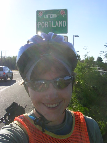
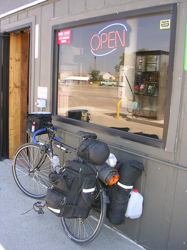
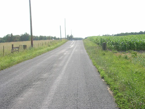
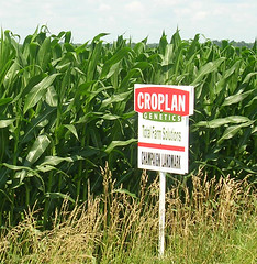
Portland
Walla Walla, WA -- Last night the nice folks I'm staying with here outside Walla Walla offered me clam chowder and I realized that I probably don't need to be as suspcious of seafood as I have been since I'm in a state with a coastline again. I've still been asking people for directions and tips on how to move forward, but I'm getting close enough there are really only a couple roads that run from where I am towards Portland.
I've been thinking, though, about all the directions I've gotten since I started and all that I've been told about the roads ahead of me by people who've been on them. I met a man in Bartonville, IL who had been all around the country on his motorcycle and who now worked, in his retirement, moving new cars between dealerships in the midwest. He had been in all of the contiguous states, riding twelve hour, sixteen hour, thousand mile days. He once rode from Denver to Reno, he told me, on the loneliest higway in America. He went to whole way on only two bottles of Gatorade.
When I told him I was from outside Boston. "Oh," he said, "Route 95." I said I'd be headed due west across Iowa and he told me it was three hundred and two miles on Interstate 80. Heading due west, he figured, I must be going through Denver, right? Before he could give me the mileage for that, I told him that no, I wouldn't be going through Denver. Denver is actually a bit south of Bartonville, but if you get on 80 West and don't stop, it'll take you there.
When I ask people for directions, they describe distances in terms of time in a car, they never think I can cover as much ground in a day as I can, and they usually don't know the backroads as well as they know bigger ones. People are much less likely to tell me the direct, diagonal county road to where I'm going than they are to tell me to go ten miles straight north on a highway with a 60-plus speed limit and then ten miles straight west on another. I do it too. When people ask about where I'm from I describe a town about half an hour outside of Boston
It makes sense, I suppose, that a person's mental geography reflects the things they do, the places they go, and how they go there, but I'd never given it much thought before this trip. People often don't notice whether they're going uphill or downhill because they're driving, and I've been tipped off to "short cuts" that end up being really steep climbs. I also get directions that reference local landmarks -- the local Wal-Mart or grocery store is a common one. I can also tell where people don't go from what they say to me. In Piqua, OH, a man in a diner told me that I was over four hundred miles from Indianapolis, but the actual distance was more like a hundred and twenty.
My mental map of the country, of course, has changed considerably since I started. Being able to conjure up images of places in South Dakota, Iowa and Idaho when I see them on a paper representation of the continent makes a world of difference, ad even having heard about places changes the way I think about them. In Orofino, a man told me he once drove on the lonliest highway in America and I said, "Oh, Reno to Denver."
Well, it's onwards for me. It'll be less than I week until I get to Portland, and I might not post again until then. Last night someone asked me if I was sad about my trip being almost over, and I almost surprised myself with my answer. I said that I hadn't thought about it, but that I was just about ready to be done. I've seen what a lot of people's lives are like in a lot of different places, but I'm about ready to see what my life is going to be like.
Still in Orofino, ID -- Two things happened that led me to spend the last two days in Orofino, and it's turned out to be an excellent stop on my trip.
For starters, Orofino is having Lumberjack Days, which is the county fair for Clearwater County and an occasion for a lumberjack competition. That's the first thing, and it led me to ask at the fire station where I might camp in town for the night so that I could see the fair. There, I met the county's wonderful emergency manager. That's the second thing. I've been camping in his yard and hanging out with his family, and they're all a whole bunch of fun.
The Dworshak Dam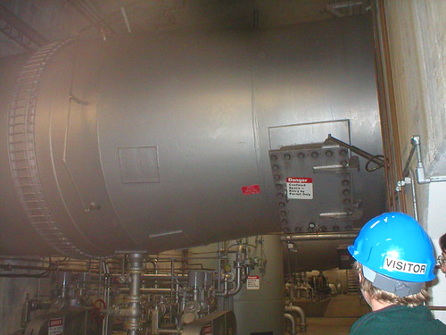
One of my host heads-of-house works at the Dworshak Dam, a 717 footer across the North Fork of the Clearwater River a little ways out of town. She took me in on an after-hours tour of the Visitor's Center, the North Tower, level 1603 (1603 ft above sea level), and then down into the Power House where the plant's operator showed us his control room and the switches, pistons, rotors, breakers and other things that make electricity out of water.
The operator can run everything from the control room. There were probably 9 or 10 computer monitors in it, in addition to all the LED displays and lit-up dials. We saw the old, manual controls on one of the generators, breakers for the electricity that gets generated, and we got to listen to one of the generators whir around as the water passed through it.
The dam, which does have the distinction of being the highest stright-axis gravity dam in North America (for you damophiles out there), has three generators, but only one was running because it's late in the season and water levels are pretty low. The dam is owned and operated by the Army Corps of Engineers, but it sells its power to the local electric company and sends it to the town of Ororfino as well as to places further afield in the Northwest. The Dworshak is one of eight in the way of Salmon and Steelhead trout that come this way from the Pacific to spawn. Their stop up in these parts is the Dworshak Fishery, just downshtream from the Dam, and they make quite a journey to get here. Some of the dams have fish ladders and various other contraptions to help fish around them, but in some places the Federal Fish & Wildlife administration actually scoops the fish up on one side of the dam, puts them in water-filled trucks, and brings them to the other side.
At the Dworshak Fishery the eggs are collected from adult fish, the fish spawn, and some orther fish things happen. I don't understand all the details of that after talking to one former and one current employee of the fishery, but I do understand that it's massively expensive. The dams seem to work more or less like this: the government builds these dams and sells the power. It has to pay out the nose, though, to mitigate the disasterous effects the dams would otherwise have on the fish. So there's cheap, clean electricity in the Northwest, but the government subsidizes it both by running the dams and taking care of the fish. Why bother, having dams at all, then? Well, conveniently, they're a power subsidy that doubles as a farm subsidy. The downstreams dams all have locks and they make it possible for grain to go downstream to Portland and overseas from there.
So the dams allow power and grain to travel around the Northwest, but they impede the progress of fish on the river, and they also impede the path of logs. When the Dworshak Dam was completed in 1971 it was the end of log drives down the North Fork of the Clearwater, and timber has been trucked rather than floated to market ever since. Timber is still big business around here, though not as big as it once was, and culturally important. Hence...
Lumberjack Days
Friday and Saturday were the usual county fair stuff -- food, rides, prize-winning vegetables and a 4-H auction -- and Sunday was a lumberjack competition. Both days of the fair were a lot of fun. There was an exhibit hall that had prize winning fruits, art projects, and baked goods, as well as booths put up by a variety of organizations. Basically, it was one of my dreams come true -- a whole bunch of knowledgeable, friendly people lined up and waiting for me to ask them questions.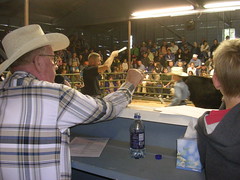 I talked to people from the Forest Service, Fish and Game, various political candidates (There's a particularly heated race for Clearwater County Coroner this year.), and a man who makes and engraves knives. I also went to the 4-H auction for a while to see the animals and listen to the auctioneer. A good day at the fair.
Today was the log show -- pretty much a timber industry version of the rodeo. People compete in skills that used to be what loggers did at their jobs. I talked to a team memeber from Washington State University and she explained to me that it's actually quite widespread and well organized under the American Lumberjack Association. There's also a good deal of international competition, she said. Australia and New Zealand have some great loggers, apparently.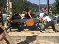 There were a bunch of events in the Orofino show. Competitors chopped wood in various ways, threw axes at a target, climbed sixty foot poles, sawwed logs (by hand and with chainsaws, alone and in pairs) and performed various agility events. My favorite was birling , which tests skills that a lumberjack or lumberjill would have used in the days of the log drives when they were floating logs down the river. Two people stand on a log floating in a pool of water and each tries to spin and stop the log with their feet so that they knock the other person off. One Lumberjill (I may have had a crush on her. Okay, I had a crush on her.) who had competed internationally did an especially good job at the birling. She made it look easy, but it ws pretty clear from a lot of the other Jacks' and Jills' performances that it isn't.
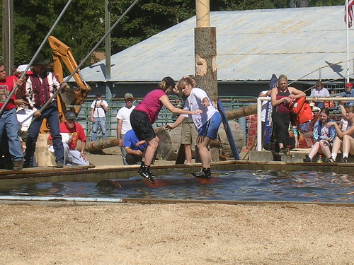
My stay in Orofino has been a lot of fun, but onwards I go. Portland seems almost in sight -- I'll be in Washington state by the end of tomorrow. I've already succeeded in one of the goals of my trip, though -- I made it out of the mountains before the snow. It snowed on Lolo pass yesterday, where I camped two nights ago.
Oh, and one more thing. I was interviewed by a reporter from a local online news service. I don't know when the story will go up, but you can check for it and learn more about the fair and everything else going on in Clearwater County at Window on the Clearwater.
Orofino, ID -- Whoever decided that "Idaho: Famous Potatoes" would be a good license plate motto owes the state a serious apology. Better, I'd say would be "Idaho: Surprisingly Gorgeous" or since the damage has already been done, perhaps "Idaho: Much More than Potatoes."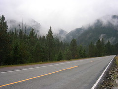 Yesterday, my first full day in Idaho, was my best, or at least most luxurious, day of riding so far. Someone told me at the campground that my day was going to be all downhill and I was skeptical. People tell me that sort of thing all the time when I ask for directions and they're usually just wrong. It's not their fault -- it's hard to judge slope from a car -- but they're usually wrong.
Yesterday, though, this guy was not wrong. The 70 to the next town miles were actually all downhill. Well, if you added in a few flat parts and the occasional mild upward slope, 68 of the next 70 miles were downhill. Not brake-screeching, trying-to-stay-in-control downhill -- I still had to pedal. But for my minimal investment of energy in pedaling, I got a return of around 18mph, instead of my usual 12mph. 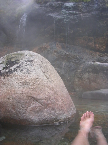 It was chilly and low clouds hung in the valley, but it made for a scenic gray day's ride and the relatively low temperature made it all the better when I stopped for a short hike into the woods to a hot spring someone told me about in Missoula. There was a bridge over the river (I had to wait for a man on horseback leading a string of pack mules to cross before I did) and then about a mile's walk through the woods to get to Jerry Johnson Hot Springs, where hot water poured down a short cliff and into Warm Springs Creek below. The hot water pooled in some rocks before running into the stream and I sat in it for a while enjoying the water and the view of the foggy, drizzly woods.
I rode on after that to the town of Lowell, through the gorgeous, undeveloped Lochsa River Valley. The road ran through the Clearwater National Forest, which was separated by the river from the Bitteroot National Wilderness Area. I had been planning to camp at a Forest Service campground, but the shopkeeper in Lowell told me that for a dollar more, I could camp at the motel/resort in town, and use their showers, pool, and hot tubs. That's a lot of hot water for one day. Jerry Johnson was better than the chlorinated warm pool I read my book in under the stars, but I didn't complain to the management.
I met a man at a roadside historical marker and he said he was envious. I didn't say it then because it didn't seem right, but I would be, too.
Missoula, MT -- Since South Dakota, things have been catching on fire. A cigarette butt will do it, or if it's dry enough, a combine hitting a rock can spark one, but usually lightening starts the land burning.
I drove around with two ranchers during a storm and every time a bolt of lightening hit the horizon they grimaced. The next day was going to be a long one, they told me, of putting out prairie fires. Nothing would burn much that night -- it was raining, after all -- but the few embers that the lightening sparked could keep themselves going over night, and when the wind picked them up in the morning and blew them to some fresh, flammable dry grass, the fires would start.
In Hobson, MT, I woke up in the middle of the night to a blaring siren coming from downtown. Alarmed and bleary-eyed, I walked a few blocks wondering if it was a tornado warning or an air raid siren. It was a fire. Fifteen miles out of town, a haystack had been lit up by a lightening bolt and the siren was to bring everyone who could to come and try to contain the burning. Even the quickest response couldn't salvage the hay -- this rancher will have to buy winter feed for his cattle this year, or if he can't afford that he'll have to sell them.
Over the next week or so in the plains I rode through quite a few blackened, barren patches of land that smelled strongly of charcoal. Range fires move fast because dry grass burns fast. Fires can race across grassland and leave almost nothing behind them. Because of this, though, a contained fire will run out of fuel relatively quickly and burn itself out. Those same embers that may have started the fire, though, need to be watched so that they don't start things up all over again.
A pair of Wyoming brothers told me about one of the first fires they fought, back in their teens when they were barely old enough to be helping out and excited to be there at all. Their detail, though, wasn't exactly thrilling work. They were left in charge of the site after the flames had been extinguished and it was their job to watch and wait and spray any embers that flared up. The two of them had to sit there for hours, they said, before anyone showed up to relieve them.
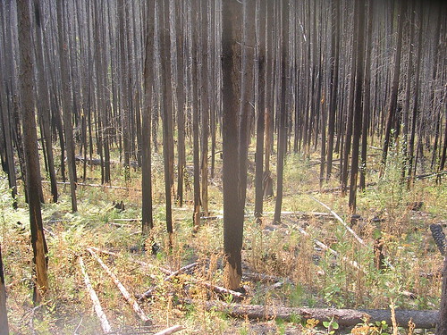
Forest fires move more slowly than range fires, but that can actually make them harder to contain. A camp fire can burn for several hours, after all. Imagine a campfire made of trees instead of logs. Forest fires are also usually harder to get to than range fires. When a lightening strike starts the mountains burning, the fire can be miles away from the most primitive road, and no one might even notice the fire until it grows. I rode through Glacier National Park last week, and it was scenic in the way it's supposed to be. Snowcapped peaks, blue alpine lakes, bubbling brooks and sweeping, panoramic views. But rather than the clear mountain air I was expecting, I looked at the more distant peaks through a light haze. There had been a big fire a few weeks before I got there and parts of it were still smoldering on the ridge above St. Mary's lake.
On my last day in Glacier, I picked out an 8 mile hike on the outskirts of the park, which I was hoping would be a little less crowded than the more central trails. The Northwest part of the McDonald Valley, where my hike to Apgar lookout was, had burned from mid-July of 2003 until the snow started falling that year. Fire crews had it more or less controlled by late August, and they kept it from harming much property or infrastructure, but thousands of acres of forest burned.
Minneapolis, MN -- I've been taking a break. I took the train from
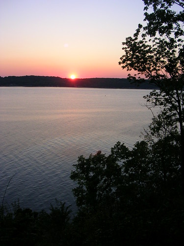
Shelby, MT to Minneapolis to see some friends and go on a canoe trip in the Boundary Waters -- a series of lakes in northern Minnesota along the Canadian border. I can't post pictures at this time, but trust me, it was gorgeous, and all the more so because the lakes and trees were a welcome contrast to so many miles of rolling, dry Montana plains.
This side trip has been full of welcome contrasts, actually. I've liked being in a city and having a variety of people all around me all the time. I've liked being able to hang out with people who share my background and situation to some degree -- recent college grads. It's been nice to stay in one place, and to go on a trip that someone else planned, and to have more than two radio stations available. It's been a very comfortable trip.
It's also been interesting to watch myself interact with strangers, here, though. On a somewhat stressful trip into strip-mall-land to replace my broken cell phone I found myself fairly annoyed at the leisurely cashier who tried to tell me jokes while checking me out. I would have listened to him gladly and probably even tried to further the conversation if I had been in small town Montana. Maybe that's just a habit that resurfaced with being in a city, but it's one I need to break. One of my favorite parts of my trip has been just listening to the things people tell me, and it'd be a pity to stop listening in major urban areas.
My train back to Montana leaves tonight so I'll be back on my bike and spending some time in Glacier National Park within a few days. Keep your fingers crossed against high altitude snow.
Harlowton, MT -- There's no better conversation starter than showing up somewhere on a loaded bicycle, but it almost always starts the same conversation.
Q: Where are you coming from? Where are you going?
A: Coming from Massachusetts, going to Oregon.
Q: All by yourself?
A: Yes, all by myself. And I like it this way. I can do whatever I want.
Q: Why? Are you raising money for charity or something?
A: Wanted to see the country and I don't have a car.
Q: Aren't you scared? There are a lot of bad people out there.
A: Sometimes I get nervous, but everyone's really nice. I keep hearing about these bad people, but I haven't met them yet.
Q: How many miles do you go in a day?
A: It depends on weather, hills, and distances between towns, but I average around 60 miles a day.
Q: I couldn't ride a bike to the other side of town. Isn't it hard?
A: Never so hard that it isn't worth it.
Billings, MT -- Excited to be taking a Sunday off from riding in the big (90,000 people) city of Billings, I went downtown to buy myself a Sunday New York Times. I was told with a smile that it would be in on Thursday and that they only ordered a few copies because not many people wanted the news four days late. There just wasn't any good way to get the paper to Billings.
Portland is further away from Boston than Billings is, but I'm learning that a place's geographical location isn't always as important as the sort of networks that it's in. In the farm country of central Illinois I was only a couple hundred miles from Chicago, but I couldn't find the Chicago Tribune anywhere.
I'll be able to get the Times in Portland. I think the East Coast will end up being closer to the West Coast than to a lot of places in between.
Billings, MT -- So much has happened that this is going to be a two for one special. Lucky you. The next entry's below.
Northeasterner goes West  About the time I got to South Dakota, I realized that this is not the country I grew up in. There are no trees. Sometimes I see a town on the horizon and it takes me two hours to ride there. I see antelope by the road that I can identify only because I saw them in the computer game "Oregon Trail."
I find myself talking more and more about Massachusetts to people out here. In Massachusetts, you're always in a town and the interstates are four lanes in each direction, not four lanes total. In Massachusetts, we don't need to worry much about the whole landscape catching on fire or being snowed into our houses six miles from the road. In Massachusetts, you don't need to drive sixty miles to the grocery store, and the economy doesn't depend on the weather.
The distances out here make me nervous. Forty miles isn't unusually far between towns, and it's noteworthy if I see one or two houses in the course of the ride. There might be signs or gates for ranches, but those are usually miles off of the paved road so I never see them. I find myself a lot more concerned out here with getting to the next point on my map, whether it's a town or an intersection. Part of that is practical -- if I can't count on being able to fill up a water bottle for forty miles, I need to carry about ten pounds of water. Part of it, though, is just that I'm not used to geography like this. I can feel myself getting slightly anxious when I look around and the road I'm on and the fence I'm next to are the only signs I see of people.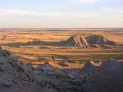 I thought about this a lot when I visited the Badlands back in South Dakota. The land there is bizarre and intimidating by any standards, and especially by mine. There are dry grasslands and then these peaks and rocky formations made of crumbly, dry soil and stone. Apparently the Badlands were formed by rivers, which cut all of these dramatic outcrops out of the sea bed. You can tell that they came from water -- there are canyons and little channels cut into the rocks, but the Badlands get less than 16 inches of rain a year. While I was there, it rained for five minutes and a ranger told me that was probably going to be it for precipitation this month. Walking around after the rain, I could barely tell it had happened. The ground was dry and cracked again.
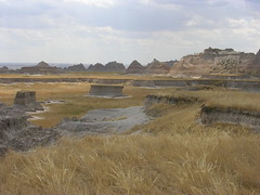 When I first arrived I thought he place must be aching for moisture, but it took me until the day I left to realize that it wasn't at all. It's those five minute rains that are not-so-slowly eroding the Badlands. They'll be gone entirely in 500,000 years. There are birds, toads, insects, and plants. It's actually doing fine without the water I've come to expect and associate with a healthy earth.
To put it simply, this is not New England. My ideas about land and landscapes no longer apply. Out here, I'm usually so awestruck by the hugeness of the places I see that I don't actually see much of what's in them. I spent a wonderful day with a guy that I met in Alzada, MT, and he drove me around the Black Hills and Northeastern Wyoming showing me the sights. He pointed things out to me at great distances -- cows, deer, antelope -- that I usually couldn't see at all. At first I thought it was my eyesight but I think it's actually the way my eyes are trained. How can I see a deer when I'm trying to process a view that includes a massive sky and a horizon that could be twenty miles away? As we drove, I could feel myself getting more and more used to it, but he still said things sometimes that reminded me I was in a very different place. If someone responds to a 911 call in an hour, that's really pretty fast. He went to high school 35 miles from home.
I'll be here for a while -- it's big out here -- but I still may not have adjusted to the prairie by the time I hit the mountains. It's different. Life is different. I'm glad to be getting to see it. Right now I'm in Billings, staying with a RAGBRAI connection, and I'm going to see my first rodeo tonight. Then on towards the Rockies. Onwards and upwards, in the most literal sense.
White Girl in Indian Country
Billings, MT -- I picked up a pretty good book, Neither Wolf nor Dog at a Lakota museum's gift shop in South Dakota. It's kind of a novel, kind of an oral history project, and quite readable -- I'd recommend it. It's got me thinking about passing through these reservations. So here's what I've been thinking going through Indian Country, right, wrong, ignorant, or whatever it is.
Every time I come near an Reservation, white people start warning me about it. They tell me not to spend the night there, to be careful riding through. Have I thought about taking another road that goes around? I'll probably be fine, they say, but don't ride through on a weekend and just don't spend the night. Be careful. There's a lot of unemployment in those parts, they tell me, and that means people have more time to get into trouble.
I don't know if they have any reason to say those things. I'm skeptical, because isn't that what white people say about ethnic neighborhoods all over the country? But I'm wary, because I'm not from here and the all I know about the places I go is what people tell me. Maybe traveling by myself on a bicycle isn't the best time to try to test the line between caution and prejudice, I tell myself.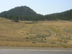 So I stopped just short of the Northern Cheyenne Reservation on Wednesday, rather than ride another 20 miles to the reservation town of Lame Deer, and spent the night in Ashland, MT. Even there, people made me nervous. I was told not to camp in the city park or almost anywhere else in town because of safety concerns -- people get drunk and are out at night around here, I was told. I ended up camping on a nice woman's lawn before setting off to ride across the Northern Cheyenne and Crow reservations on Thursday.
The road towards Lame Deer went up an awfully big ridge almost as soon as I started. It took me about an hour to go the five miles up it, and I was sweating, grumpy, and trying to catch my breath at the peak when a car pulled over to talk to me. There were three men in it, and the driver was very friendly. He introduced himself, said he was from Lame Deer, and I chatted with the three of them about my trip. He had relatives in Massachusetts, and he and his younger passengers started telling me about the road ahead. The worst of the climb was over, they said, and I was glad to hear it. I had a big downhill into Lame Deer to look forward to, and then rolling hills most of the rest of the way.
The driver also told me that if I took the next gravel road on my right, I'd take a loop past some ice wells, where the water stayed frozen all year. A little further down the road was Crazy Head Springs, where there was a Cheyenne Language Immersion program and a great spring. He told me that Cheyenne water was good water, and that if I took some and took it with me it would get me where I was going. The other two men in the car laughed at that, and he said that they didn't believe it, but that I should get some water anyway. He told me his name again and said that I should tell people in Lame Deer I knew him. They'd treat me well, he said.
It was just what I needed after that climb -- a talk with some locals and the prospect of some neat sights off the beaten path. It lifted my spirits. As I turned down the gravel road, something started in my head. Somewhere in the unwritten handbook for solo female travelers there is probably a line that specifically advises against going down bumpy gravel roads that no one knows you're taking (except three strange men you've just met) in an area that people have told you is unsafe. I kept riding, though. I didn't want to pre-judge the reservation, and I've found that tips from locals usually lead me to cool places to explore.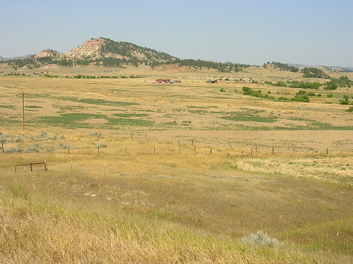 I came to some cows and saw two people on horseback riding on a hill with the rest of the herd. They must have seen me, but didn't acknowledge the probably unusual sight of a white girl on a loaded bicycle coming down their road. They were too far away to call out to, but I found myself wanting to yell my friend in the car's name to them, and tell them that I had been invited. Instead, I turned around and rode back to the road. Perhaps despite the invitation, this was not my country to explore. There are plenty of other roads out there, already stolen, for me to ride down without invading a cattle pasture on Native land.
Or was I just scared? Maybe. By the time I got to the turn off for Crazy Head Springs I had convinced myself that I was just scared of those horsemen's anger or disapproval. Crazy Head had a sign on the highway, and there was that school I could look for. I could explain myself to someone, drop the driver's name, get some water, and then continue my ride. No reason to be scared. No reason to believe that the reservation was any more threatening than anywhere else. No reason to treat the place or the people with anything other than my usual friendly and open approach.
I took the turn down a dusty dirt road and got to the sign for the school, which was directly after a sign informing visitors that non-members of the tribe needed a permit from an office in Lame Deer. I was thinking about whether it was more oblivious to go get a permit or to wander around without one when I realized that the most oblivious thing I could think of doing would be to show up asking, in English, for special water at a Native language immersion school. I turned around again. I think there is a reason to treat the reservations differently, but it doesn't have to be fear. My usual approach to people -- friendly, open -- assumes that I'm entitled to be there talking to them, and though this whole country is stolen land I'm not entitled to explore, I'm especially not entitled to explore these reservations.
The ride into Lame Deer was all down hill, like they said. I bought a liter of Aquafina at the grocery store, chatted with and old man outside, and stayed on the highway until I was out of the Northern Cheyenne and the adjacent Crow reservation, fifty miles later.
Billings, MT -- Every time I come near an Indian Reservation, white people start warning me about it. They tell me to be careful riding through and ask if I’ve thought about taking a different road. I'll probably be fine, they say, but don't ride through on a weekend and don't spend the night. Be careful. There's a lot of unemployment in those parts, they tell me, and that means people have more time to get into trouble.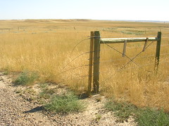 I don't know if they have any reason to say those things. I'm skeptical, because isn't it what white people say about ethnic neighborhoods all over the country? But I'm wary, because I'm not from here and all I know about the places I go is what people tell me. Maybe traveling by myself on a bicycle isn't the best time to test the line between caution and prejudice, I tell myself.
I stopped just short of the Northern Cheyenne Reservation on Wednesday, rather than ride another 20 miles to the reservation town of Lame Deer, and spent the night in Ashland, MT. Even there, people made me nervous. I was told not to camp in the city park or almost anywhere else in town because of safety concerns -- people get drunk and wander around at night around here, the clerk at the post office said. I ended up camping on a nice woman's lawn before setting off to ride across the Northern Cheyenne and Crow reservations on Thursday.
The road towards Lame Deer went over an awfully big ridge right away. It took me about an hour to go the five steep miles up it, and I was sweating, grumpy, and trying to catch my breath at the peak when a car pulled over to talk to me. There were three men in it, and the driver was very friendly. He introduced himself, said he was from Lame Deer, and I chatted with the three of them about my trip. He he and his younger passengers started telling me about the road ahead. The worst of the climb was over, they said, and I was glad to hear it. I had a big downhill into Lame Deer to look forward to, and then rolling hills most of the rest of the way through the Cheyenne Reservation.
The driver also told me that if I took the next gravel road on my right, it would loop past some ice wells, where the water stayed frozen all year.  A little further down the road was Crazy Head Springs, where there was a Cheyenne Language Immersion
program and a spring. He told me that Cheyenne water was good water, and that if I took some with me it would get me where I was going. The other two men in the car laughed at that, and he said that they didn't believe it, but that I should get some water anyway. He told me his name again and said that I should tell people in Lame Deer I knew him. They'd treat me well, he said.
It was just what I needed after that climb -- a talk with some locals and the prospect of some neat sights off the beaten path. It lifted my spirits. As I turned down the gravel road, though, I thought about what I was doing. Somewhere in the unwritten handbook for solo female travelers there is probably a line that specifically advises against going down bumpy gravel roads in reputedly unsafe areas that no one knows you're taking except for three strange men you've just met. I kept riding, though. I didn't want to pre-judge the reservation, and tips from locals have led me to some fun sights in the past.
I came to some cows in the road and saw two people on horseback riding on a hill with the rest of the herd. They must have seen me, but didn't acknowledge the probably unusual sight of a white girl on a loaded bicycle riding towards their herd. They were too far away to call out to, but I found myself wanting to yell the driver’s name to them, and tell them that I had been invited. Instead, I turned around and rode back to the highway. Perhaps despite the invitation, this was not my country to explore. There are plenty of other roads out there, already stolen, for me to ride down without invading a cattle pasture on Native land.
Or was I just scared? Maybe. By the time I got to the turn-off for Crazy Head Springs I had convinced myself that I was just afraid of those horsemen's anger or disapproval. Crazy Head had a sign on the highway, and there was that school I could look for. I could explain myself to someone, drop the driver's name, get some water, and then continue my ride. No reason to be scared. No reason to believe that the reservation was more threatening than anywhere else. No reason to treat the place or the people with anything other than my usual friendly and open approach. I took the turn down a dusty dirt road and rode to the sign for the school, which was directly after a sign informing visitors that non-members of the tribe needed a permit from an office in Lame Deer to use the area. I was thinking about whether it was more oblivious to go get a permit or to wander around without one when I realized that the most oblivious thing I could possibly do would be to show up asking, in English, for special water at a Native language immersion school. I turned around again.
I think there is a reason to treat the reservations differently, but it doesn't have to be fear. My usual approach to people assumes that I'm entitled to be there talking to them, and though this whole country is stolen land I'm not entitled to explore, I'm especially not entitled to explore these reservations.The ride into Lame Deer was all down hill, like the men in the car had told me. I bought a liter of Aquafina at the grocery store, chatted with an old man outside, and stayed on the highway until I was out of the Northern Cheyenne and the adjacent Crow Reservation, fifty miles later.
Belle Fourche, SD -- This will be rushed, I'm just stopped at a public library on my way to Alzeda, MT for the night. I may update with pictures when I have more time, but here's a quick summary of the last few days.
I rode out of Pierre without incident and spent the next night in the little town of Midland, which is unlike other towns in the area because they have hot water underground at 3600 feet. Most towns in the area don't have drinkable water, apparently. People drink bottled water or truck it in. Anyways, in Midland I talked with a man who digs water mains and I saw, mixed in with postings of cars for sale and town meetings, a photocopied flier for the Rapid City Pride and Diversity festival that coming Saturday. I moved on to the Badlands the next day, and spent a day there being awestruck. More on that later, I think.
I got into Rapid City on Saturday after leaving the Badlands and found my way over to the Pride Festival. Some political candidates spoke, there were information booths, and they gave me a T-shirt advocating the defeat of the anti-same-sex-magrriage amendment that's up for vote this fall. It was a nice little affair in a small park, and some local singers performed. Apparently it's Rapid City's second Pride -- the first was in 2003. I was adopted by some folks from Vermillion and the University of South Dakota and stayed with them at the house they were at for the night. I also went with them to the party that happened that evening at a pub in town. Okay, I'll be honest: compared to New York or Boston Pride, it was not particularly overwhelming. At the peak of the evening, there must have been 25 people on the dance floor, and maybe twice that back at the bar area. I liked it, though. There was one song they played part way through the evening with the chorus, "If you're going through hell, keep on moving...you might get out before the devil even knows you're there". It's a current hit on the country charts and was the only country song that was played all night, but people started dancing with arms hooked and it seemed happy and hopeful. There weren't many people there, but there were enough, and at least to an outsider they seemed to be having a good time. I don't know how to describe it, but it had some sort of communal feeling that I never noticed in the crowds of Boston or New York City Pride.
There are motorcycles everywhere out here. This is Sturgis Bike Week and somewhere in the neighborhood of a million people are going to be riding their Harleys, Hondas and choppers around the Black Hills. It seems like a million people already are. I've been seeing people on their way to Sturgis since entering South Dakota, and riding around here is practically deafening. (Before you go worrying about me on my own in the midst of all these bad bikers, let me say that some very nice riders hauling their bikes out to Sturgis behind their pickup gave me a ride and saved me from having to bicycle on Interstate 90 when it was the only road out of town. They were really friendly.) People come from all over the country and the world to be here, go to races, buy T-shirts, ride the Hills, and be surrounded by other rebellious folks in leather with their counter-culture hair blowing in the wind and engines roaring who love riding their motorcycles. It's absolutely huge, now, of course, but it started small. I think with all the tough-guy imagery I'm supposed to be intimidated by the riders, but I keep thinking (despite the racket) that it's kind of sweet. Especially at the beginning, I think, it must have been a lot like Rapid City Pride.
Pierre, SD -- So far, South Dakota has been dry and hot. On Saturday, Jim drove me up here and on Sunday I decided to spend the day in a motel as temperatures hit a hundred and twelve. Yesterday, when the forecast predicted a comparatively low peak of a hundred, I thought it might be a good day to make the eighty-mile ride to Pierre.
I left at five in the morning to get as many miles in as possible while it was cool out, but even before the sun rose it was in the high seventies.  The early morning ride was pretty, though. I would do it again just to be out with the sunrise. I rode through the Crown Creek Indian Reservation and stopped at a place on my map called Mac's Corner.
I expected a town, but in fact it was just a gas station called "Mac's Corner." The cashier said she didn't know how it had gotten on the map, but that it had always been there. After that, there was nothing until Pierre. I know there are a lot of Northeasterners reading this and there was a time when I would barely have believed that, either. I rode for at least a day before I could really say that I had gotten out of the Boston suburbs -- how could there actually be nothing for almost 50 miles outside of a state capitol? It still doesn't quite make sense to me, but I can tell you that there's nothing between Mac's Corner and Pierre.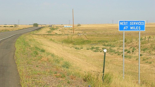
Well, there were at least a few houses in the first twenty miles, a few dirt roads promising other towns in 15 to 20 miles, and cars passed every five minutes or so. Normally a car-free road would sound good to me, but I was glad for what traffic there was. Not only was it hot, but there was no shade at all. While the sun was still rising in the sky, bales of hay by the side of the road made a shadow of a few square feet, but there were only very occasional trees, and they were behind barbed-wire fences providing shade to a few huddled cows.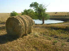 Central South Dakota is having a terrible draught, I learned. They're far below the rainfall they should have at this time of year, and you can tell it by looking around. Farmers are having to truck their cattle to pastures that actually have grass or if they can't do that, just to sell the cows because there's nothing to feed them. The corn crop is shot -- there's no amount of rain that could save it now. Aside from two or three fields I saw watering their crops, the corn was dried out and light brown, just like the rest of the landscape. The most dramatic indicator of the drought that I saw was a farmer who had taken to his corn field with a hay baler and just started to bale the corn stalks, ears and all. It was so dried out that it was worth no more than hay.
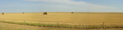
I didn't take a picture of that, though, because I saw it from the window of a pick-up truck. About 11:30 I felt like all the water I was drinking wasn't doing enough to combat the heat, so I stuck out a thumb and got picked up by the rural route mailman. I helped him deliver mail for a couple hours, tried to drink a lot of water and eat something, but I was a bit too woozy to fully enjoy the experience. When I got to Pierre and the folks' house that I was staying at, I started vomiting and ended up in the ER being rehydrated. Oops. I was carrying tons of water and thought I was drinking plenty (more than a liter an hour), but I think I just underestimated the combination of the heat and having nowhere to rest in the shade. Hello, South Dakota. I've learned my lesson, though. I'll be planning a short day or a rest day next time it looks like it's going to be that hot.
Just a little while after the postman picked me up, a cooler front moved in that should keep things in the 80's and 90's for the rest of the week. I'm resting today (doctor's orders) but this would actually have been a perfect day to ride -- it's about seventy-five and overcast. Tomorrow, though. Onwards and westward.

Des Moines, IA -- If you're wondering why I haven't posted in a while, here's an answer you may not expect: I was swept up in a crowd of 15,000 bicyclists riding across Iowa from West to East. The Des Moines Register's Annual Great Bike Ride Across Iowa, RAGBRAI, crosses the state every year and draws thousands of riders, so for the few days preceding it, a lot of people who saw me with my loaded bicycle figured I must be heading for the starting point. Every time but one, I just explained myself and went on my way, but on a bike path outside of Des Moines I met a group who just wasn't satisfied with my "I'm heading in the other direction" line. They told me that RAGBRAI was an experience not to be missed, and that if I rode it back to Des Moines, they'd drive me west again so I didn't lose too much time. And so began my adventure. These folks were pulling bike trailers with their gear, ("Trailer Trash," they called themselves.) and riding with them was a change in my routine. We slept later, stopped in bars in towns along the way, and generally took it easy. I haven't been powering through places too quickly, but taking it slow for a few days was really nice. We met a really cool young woman who had bought the bar she used to work at in Panora, and in Lidderdale I had the best prime rib dinner of my life. I left them at a campground on Sunday and rode on to a RAGBRAI overnight town to see the show and join the big ride the next day.
And what a show it is. Aside from the fact that it still involved riding my bicycle all day, RAGBRAI had almost nothing to do with the rest of my trip. The ride does require people to do pretty good mileage every day -- 60 to 80 miles, usually -- but they don't have to carry their gear, there are people selling food all along the roads, and every town the ride passes through is like a big party. Actually, the whole ride is like a big party. People dress up themselves and their bicycles, eat and drink to excess, and even decorate the road kill they pass. In the overnight town where I picked up the route, Ida Grove, I met the Subtle Savages in between getting a gyro (only one of many dinner options) and getting a beer (I'm not sure if Miller Light is an official sponsor, but they may as well be).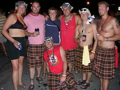
RAGBRAI has a tradition of teams that ride the route together, have team support veichles to carry their gear, and party together every night and in towns along the route. The Subtle Savages distinguish themselves by wearing kilts instead of bike shorts, (yes, instead of bike shorts, not over their bike shorts) have a well-appointed remodeled red school bus, and party as hard, if not harder, than they ride. 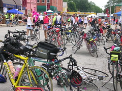
I hung out with them that night, and rode with them on and off for the next two days. My bike path friends sure were right -- RAGBRAI was unlike anything else. By the time I finished, I had was wearing two bracelets from bars identifying me as of legal drinking age, a Michelob Lite pendant in the shape of the state of Iowa strung onto Mardi Gras beads, and my left thumbnail had been painted blue with a white bicyle on it.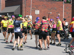 So it was quite an experience. I'm in West Des Moines right now, staying with these Trailer Trash folks, and true to their word, they're going to give me a lift onwards this weekend. I'm going to head into South Dakota. I want to see the Badlands.
Iowa's only about three hundred miles across, but it's going to end up taking me about ten days from entry to exit. It's been well worth it, though. South Dakota's got a hard act to follow.
Fairfield, IA -- Well, I've crossed the Mississippi. I'm not very far into Iowa, though. This morning I only rode about thirty miles before stopping for a snack here in Fairfield. I went to the Second Street Coffee House expecting a diner, but was served by a long-haired young man in a tie-dyed T-Shirt that reminded me more of Northampton than the Midwest. I got to talking to people and found out that the city is a center for the Transcendental Meditation movement, and home to the movement's university, the Maharishi University of Management. The movement's brought a lot of people into the area, apparently, and there's lots of art galleries and performances around.  In the words of several people I met today, "it's a pretty happening place." I got to talking to people, and soon enough the owner of the coffee shop took me vegetable shopping with her then steamed me some fresh-picked Iowa corn. With that in my stomach, I explored the University's campus, went to the whole foods store, and spent some time at the town library looking at the paper and Iowa history books.
  Aside from that delicious sweet corn, though, the town barely felt like it was connected to all the corn and soybeans I had been passing. Back on the eastern side of the Mississippi, though, I stayed with two wonderful cyclists who were also farmers. In addition to taking me to a family gathering and a triathlon, and showing me around the area, they showed me the farm equipment and told me a bit about farming and marketing corn and beans. The marketing is a bigger part than I had understood, and I'm glad I know a bit more about it all as I head through more farm country.
It's been really, really, really hot -- at the worst points, I've been making thirty miles on a gallon of water. It's raining now, though, and I'm hoping things will cool down for my ride out of Fairfield tomorrow.
Lafayette, IN --Friends' cousins have been treating me well in Indiana. After a nice evening in Indianapolis I came up here, and here's quick update before I leave Lafayette. I spent another day here because the forecast called for lightening storms all day and riding my steel bicycle through soybean fields in a thunder storm didn't sound like it'd be the smartest thing I'd ever done. Rick and Paulette own a pair of frozen custard stores called Snowbear Frozen Custard. (Frozen custard, for those of you wondering, is kind of like super-creamy Midwestern ice cream. You can learn more at the site.) So on my rainy day off I hung out in the shop, eating fresh custard, drinking coffee and reading all of both the New York Times and Chicago Tribune. All you can eat frozen custard and two newspapers --can you imagine me being happier? The day before we did some sight-seeing around town and I looked around Purdue. And now I'm heading west again. Today I'll enter Illinois and even more exciting, Central Time.
 A funny noise that doesn't stop when I stop pedaling is something on one of the wheels. If it does stop when I stop pedaling, it might be something like it was today -- the end of the front derailleur cable hitting the crank arm and needing to be tucked back into place. Off the bike, cars make different noises depending on their age, type, and their distance from me. There are birds from time to time. When I go under high tension wires the sound reminds me of hearing light rain from inside a house. After the sun's been up long enough, tar on the road starts to form bubbles that crackle when my tires pop them. Rocks make a kind of snap when I run over them and bugs make a quiet crunch when they're flattened, but buzz and then tap when they hit my helmet or bike in mid-air. Sometimes people honk, but not too often.
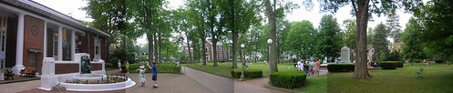
Chautauqua, NY -- I'm in Ohio now, but I didn't get out of New York State without one last interesting stopover. About mid-morning on Monday, I rode past The Chautauqua Institution, and stopped in at the visitor's center to try to figure out what it was. And, well, I'm not sure I can explain it. The woman selling postcards may have put it best when she said, "It's like a resort kind of place, but with learning." The website probably explains it best, but it runs lectures, classes, and performances all summer and people come for a week or more to go to them and hang out. It's also a sort of village with houses, a hotel, and its own post office and library. Interesting, I thought, and rode on.
A few miles down the road I saw a hand-lettered rainbow sign next to a dirt driveway that read, "PFLAG Picnic." (PFLAG, for those of you who don't know, is Parents and Friends of Lesbians and Gays.) This sign was the only remotely queer thing I'd run into since Western Massachusetts when I thought I saw a lesbian, but she turned out to be a twelve year-old Mennonite boy. I figured I'd stop in and that if I was lucky, I might get a sandwich out of it before I went on my way. I found a whole lot of friendly people, though who were quite interested in my trip and filled me up with food and drink. Some were from the town of Chautauqua, but the majority were spending at least part of the summer at the Chautauqua Institution. A lovely bicycle enthusiast invited me to come share her house with her and her grandsons and I ended up spending the next day there.  I went to a lecture about public school reform and a book discussion at lunch time, and spent plenty of time wandering around the grounds looking at the architecture and all the different buildings. It certainly is a remarkable place. The schedule of events was impressive -- lectures on all sorts of topics, musical performances and religious services for various Christian sects, classes on all sorts of topics, and programs for kids all day, every day. It's also home to the country's oldest continually running book group, which started as a correspondence course when the club had to print its own books. "It's like a little slice of heaven," said one person I met, who was there for the first time.
And I think it's because of its utopian leanings that my good ol' Wesleyan education made me suspicious of it from the start, despite how cool I thought the "intellectual summer camp for all ages" concept was. Where there are gates, people are being kept out, and there has to be something fishy going on, right? Unsurprisingly, money is an issue. To get through the gates you have to buy a gate pass for the day, the week, or the whole summer, and that's one expense, but I was interested to find that real estate is an even bigger expense. Apparently, Chautauqua privatized the land within its grounds when it was going through financial trouble in the 1930's, and in the 1990's the value of property within the gates skyrocketed. According to the Century 21 office near the drug store, a 40 foot by 50 foot undeveloped lot on the grounds starts at $279,000. Five acres of undeveloped land are available elsewhere in the county for $30,000. At the picnic, I talked to someone in the town (not Institution) government, and he said that the property taxes generated by the tiny institution grounds make up almost three quarters of the funding for the local schools. This means property taxes are becoming a major burden for people who have lived there for some time (a couple hundred live there year round) and it also means that people who buy or rent there these days are, to put it bluntly, loaded. Oh well. Still an awfully cool kind of place, though. I had been planning to pick up one of these Adventure Cycling routes soon, but I'm having a lot of fun talking to people and being the one of the first touring cyclists they've seen, rather than part of a regular phenomenon of bicyclists passing through. So I've pulled out some maps, done some internet research, and I'm just going to head west from here and see how things go. Wish me luck...
Nichols, NY -- During a particularly bad patch of rain on Tuesday, I stopped for a chocolate bar and took some pleasure in turning down a concerned older woman who offered me a ride through the downpour. I told her, somewhat smugly, that I didn't mind getting wet and rode on along the swollen Susquehanna River for the rest of the day.
When I got to Nichols, the in-laws of my Margaretville host were expecting me to camp on the lawn so I knocked to say I was going to pitch my tent. Patty told me to bring my bike up to the porch and come inside. Feeling tough again, despite the rain, I said that I had a good tent and was happy roughing it in the yard. "No," she said, and pointed across the road to the river, still running high and fast. "You don't understand. It's going to flood. Come inside." It didn't flood that night, but on Wednesday morning after Patty left for work, I was standing outside with her husband, Bob, and watching the water lap at the road in front of their house. It crossed the road at a dip a few houses down early on, and from there flooded all of the block's low-lying back yards. We stood near the yellow line until water was coming at our feet from the river on one side and the yard on the other, and since the electricity was out, we started drinking the beer in the fridge. He told me about how taxes and insurance were making it tough to run his business and about the racetrack, Tioga Downs, that had opened down the street. It was probably 85 degrees and sunny.
I grilled a burger for lunch on the back deck when the water was about 36 inches deep in the yard. One of the neighbors, whose boat had floated out of his garage, came by hip-waders to tie it up to a basketball hoop. A neighborhood cat made it onto the porch and hid under the grill. The burger was good, and I noticed I was getting a sunburn. I spread some of my damp things out to dry on the deck.
There was no shade left on the road, so Bob and I sat on the front porch. We had a couple more beers and talked a while. People in pickups splashed down the road from time to time, and each one came closer to getting stuck in the water. "There's just nothing you can do," Bob said. It flooded last year -- I saw pictures -- but the water was already higher than it had been and it was only mid-afternoon. The water was the color of coffee with milk and you couldn't see it rise, exactly, but every ten minutes or so, another knot on the porch or another piece of neighbors' RV would be underwater. But there's nothing you can do. We sat and watched it. Bob said it isn't often you get to go to the beach in New York.
We waded down the street a little ways to a house on slightly higher ground. Mike and Kathy, friends of Bob's, were pumping out their basement and trying to keep up with the incoming river. Their pump was falling behind and they were calling around, trying to find another. We helped put their new TV on raisers to get it further above the water line and Kathy made me a sandwich, gave me a beer, and wished me a happy birthday.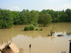 Billy, a guy my age, came up the road to try to gauge how soon his house would flood, and started up a conversation with Bob. He joined us at Mike and Kathy's for a while, and then the three of us and Kathy went back to Bob's to check on the dog. The water was lapping at the porch by now, only a few inches from the level of the door, and bugs were crawling up our legs to get away from the water.
Things were still strangely normal, though. Billy and I talked about jobs and bars, and he told me about how his girlfriend was expecting their first child in October. Bob thought he might be able to use the help doing construction, and Billy doesn't like his job driving buses, so he was excited at the prospect of different work. He said that Bob was really niceto share his beer and cigarettes and that he'd be sure to come back and hang out after the flood.
When we went back to the Mike and Kathy's, they were trying to get what they could out of the basement, where the pump was still running but water was pouring through the walls. Mike said to me, on the porch, "Man, you work your whole life, you know?" I think I said, "yeah," but I don't. At that point, my things had sun-dried nicely and I had packed them back into my bags.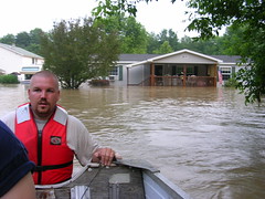 The fire department started bringing a boat around to the houses that still had people in them a little while after that. The water in Bob's front yard was about belly-button deep and the carpets had started to float. I threw both my bags into the firemen's row boat and carried my bike up the street to higher ground. Bob stayed behind with his dog and Billy and his girlfriend went back to their house, where they figured they could wait out the water on the second floor if they needed to. The Assistant Fire Chief brought me back to her house (she's married to the fire chief), where I spent last night and the day today. Her daughters took me to meet their horses just after I got here. They live on a hill near some other hills and other than there being no electricity last night, there are no signs of water.
The flooding in Binghamton, upstream, has been on the national news, and there's serious damage all over the area. The major east-west road around here, the Southern Tier Expressway, probably won't reopen for another couple days, and even some people without water in their homes might not have power for longer than that. The Binghamton newspaper hasn't delivered since Tuesday (It's unclear to me if they've even been printing it) but its website is devoted to flood news, so for the next few days you can get some of the regional picture from the The Binghamton Press & Sun Bulletin.
Bob's all right. He and the dog got out this morning, but there's just under a foot of water in the house and they can't get back in until it goes down. I'm going to go by tomorrow morning to see if I can help out. Bob thinks for now they just have to wait for the water to fall and the insurance agent to arrive. No one on their street got much insurance money after last year's flood, it seems, but there's really nothing you can do except wait for the Susquehanna to go out of the house and back the way it came. There's just nothing you can do.
I thought riding my bike across the country was mostly going to be about riding, and though that clearly isn't the case, I don't have many other options right now. There's really nothing I can do, aside from whatever work I can put into the clean-up, except keep moving. There's just nothing I can do.
Margaretville, NY -- The first thing that comes to mind is the surprising number of road kill turtles I've seen. Also more dead birds than I expected. Otherwise, things are going well. I'm learning all sorts of things. While waiting out a rainstorm at Dickenson's Farm in Ludlow, MA, a man named Michael told me that Dickenson's recently stopped providing plants for Home Depot, because they would have to take back the ones that didn't sell. A series of historic markers along Route 20 in Western Massachusetts, explained how the road opened to the great delight of automotive clubs across New England in the early twentieth century, because it's path avoided a steep, muddy hill up which motorists had previously had to be towed. The signs seem to be there to add historic appeal to the area and lure today's motorists off of their new favorite east-west road, the Mass Turnpike.
With about three-hundred miles behind me, I'm taking the day off and staying here in Margaretville with a wonderful woman whose husband is in the Dakotas right now, heading east on a cross-country ride of his own. There's a tent caterpillar infestation in the Catskills this summer, so the mountains are sort of a mottled brown, but still scenic, and it's been nice to spend time on my feet rather than my wheels.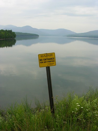 Margaretville is a few hours' drive north of New York, but riding here, I saw a lot of signs declaring land and buildings to be the property of New York City. Most of them also say, 'No Trespassing.' It turns out, this is where the City's water comes from, and at no small impact to the area, according to the Catskills residents I've talked to. As late as the 1950's, five towns up here were flooded to provide additional reservoir capacity, since the huge Ashokan Reservoir, built by flooding nine villages and finished in 1914, was no longer enough. And after the reservoirs are built, their watersheds must be protected, of course, which is why there are all these signs. New York City has bought a lot of watershed land up here (contributing to the growing problem of property values rising beyond the reach of locals, my host tells me) and restricts the use of it heavily. It's also built sewage treatment plants for the towns around here, which used to send their wastewater directly into the reservoirs' watersheds. Mostly it tears down buildings, though, on the watershed land it acquires. That improves the quality of the watershed, but also reduces the land's assessed taxable value in Delaware County. Interesting story.
Tomorrow I'm heading west across the rest of the state.